
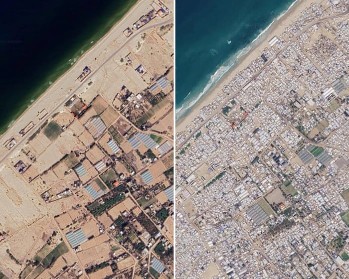
Satellite imagery shows further destruction of homes, businesses and places of worship since fragile ceasefire An update to Google Maps has revealed the extent of devastation during the three-year Gaza war and the severity of the continuing humanitarian crisis faced by the territory’s 2.
3 million inhabitants. The images were taken in June this year and show further destruction of homes, businesses, places of worship and infrastructure since a fragile ceasefire came into effect almost 12 months ago. Continue reading...